

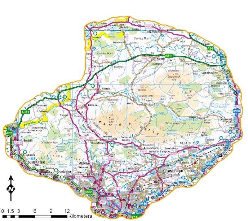
Scotland’s Rural College (SRUC) is currently undertaking work for Scottish Natural Heritage to better understand current models of lowland deer management in relation to the delivery of public interests. SRUC is collating relevant information to develop a deer management database for a 950 km2 pilot study site to the north of Glasgow, bounded by the main trunk roads and Loch Lomond to the west and Stirling to the east (see map below – click to enlarge). The area includes a mix of land uses and landownership types typical of lowland and peri-urban areas and includes areas of commercial forestry, farmland, amenity land, Local Authority land, development sites and small holdings.
The project aims to collate information relating to deer management and key areas of public interest, including woodland expansion, protection and enhancement of native woodlands and impacts on designated sites by deer. Other relevant areas include economic impacts associated with damage to woodland, agricultural crops and gardens and deer vehicle collisions and economic benefits derived from sporting leases and venison sales.
Can you help?
Are you carrying out deer management, commercial or recreational stalking in or near to the pilot area? If you are then SRUC would be very grateful if you could make contact (Simon.Gibson-Poole@sruc.ac.uk) and provide the following information by email:
- Your name and current address
- The areas in or near to the pilot study area where you stalk/manage deer
- The capacity in which you do this (private stalker, syndicate, farmer etc.)
- The number of times a year you normally engage in stalking in the area
- How you use any venison from the area including any game dealer(s) used
- Any other comments you may have in relation to your activity in this area.
Please note that all information provided will be treated as confidential and used only in aggregate form for the purposes of developing a deer GIS and carrying out spatial mapping of activity across the study area.